Material
Abstract
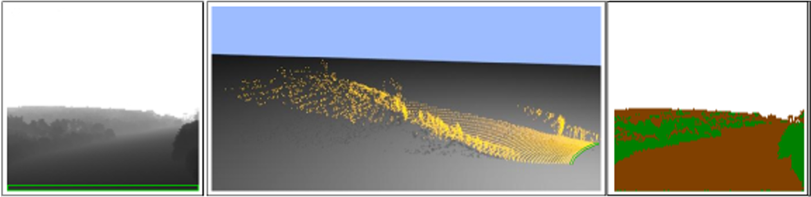
Helicopter pilots often have to deal with bad weather conditions and degraded views. Such situations may decrease the pilots' situational awareness significantly. The worst-case scenario would be a complete loss of visual reference during an off-field landing due to brownout or white out. In order to increase the pilots' situational awareness, helicopters nowadays are equipped with different sensors that are used to gather information about the terrain ahead of the helicopter. Synthetic vision systems are used to capture and classify sensor data and to visualize them on multifunctional displays or pilot's head up displays. This requires the input data to be a reliably classified into obstacles and ground. In this paper, we present a regularization-based terrain classifier. Regularization is a popular segmentation method in computer vision and used in active contours. For a real-time application scenario with LIDAR data, we developed an optimization that uses different levels of detail depending on the accuracy of the sensor. After a preprocessing step where points are removed that cannot be ground, the method fits a shape underneath the recorded point cloud. Once this shape is calculated, the points below this shape can be distinguished from elevated objects and are classified as ground. Finally, we demonstrate the quality of our segmentation approach by its application on operational flight recordings. This method builds a part of an entire synthetic vision processing chain, where the classified points are used to support the generation of a real-time synthetic view of the terrain as an assistance tool for the helicopter pilot.